Saturday 23rd August: Morning clear and 7°C, Afternoon misty and 15°C.
Macugnaga to Alagna: 29.7k: 8.30am to 6.45pm: 10hrs 15mins
Accommodation: Indren Hus Alagna

Monte Rosa behind Hotel Dufour


Onward and up to Col de Turlo

Hard Rock Cafe

Mosaic of granite slabs

Trillions of hours building this track

Mist rises out of the valley

3pm at the Passe del Turlo 2738m

Even the dogs made it

Down to Alagna into the mist

Tiptoeing along the granite edges

Catching up to Fran's Tour Group

Mum and baby donkey
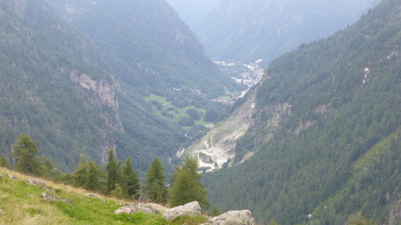
Alagna deep in the valley below

Single street of pretty Alagna

A well earned meat, fries and salad

Profile of days walk - Col del Turlo
Hilary, we are not impressed! Almost 30k today when it should have only been 19.5k - that's a 50% increase in distance! And as well as 30k, we climbed the Col del Turlo at 2,738 metres, a climb of 1421 metres above Macugnaga, then down again 1600 metres to Alagna. The highlight was seeing the Monte Rosa in all its glory first thing in the morning as a backdrop to our Hotel Dufour. Then climbing the Col del Turlo on a well graded track of mosaic granite slabs to the top then down a graded rocky mule track to the other side. Getting to the really pretty village of Alagna at 6.45pm was a great end to another hard day. Our average of 15k per day has been blown out the window!
We awake to chat Facetime with Bonnie, then Skype to Donna and Milton. Technology has allowed us to stay in touch so easily on these trips. Breakfast is a bit spartan, but the single peach between us was so juicy. It's 8.30am when we leave to a glorious morning and we can see the Monte Rosa for the first time. We briefly stop at the local Alimentari for bread and tomatoes which look red and delicious. I break the bread in half to make it fit - it's rock hard on the outside, light on the inside - Italian style bread.
Upward to the Passe del Turlo - the sign says 5hrs 50 mins just to the top and we already know Hilary's 8hr day to the top and down to Alagna is a furphy. After 3hrs of steady climbing through the pine forests, it's time for coffee on a granite slab in the middle of the track. There's not many walkers today - 4 men and 3 dogs. Out of the pine forests, the track is a mosaic of granite slabs - just like a roman road. It's rated the best track to a mountain pass in Europe. Even though the grade is steep, it’s an easy slog.
At 3pm, after 6hrs 30mins and a GPS reading of 16k, we reach the Passe del Turlo. There's a collection of people - day trippers, Fran's Tour Group, and one dog. The two men with their greyhound go back the same way - 32k for the dog that day - it's a greyhound! It's not freezing cold at the top, 7°C, not 2°C and after a brief encounter with other climbers, we have a chunk of rock bread with a hunk of cheese and head on down. We've reckoned we'll be lucky to be there by 6pm.
The track down was well graded, no high steps to clamber over, and the smooth granite edge supporting the track made it easy to tip toe quickly down whilst balancing on the edge. The centre of the track was slippery with little rocks. Soon we catch up to Fran's tour group, have a quick chat, compare notes and discover that both Ian's and Fran's GPS reading is the same at 20.7k from the start and we're only half way down the mountain! (See FOOTNOTE for an explanation of why Hilary’s measurements differ.)
We head on down between the high sides of the valley towering over the top of us to the pretty village of Alagna way below. Fran's group stops for the night half way down at the Rifugio Pastore - we stop for a quick cup of tea before walking down the last 4k into the village where we ask one of the locals for directions to Indren Hus, our Bed n Breakfast for the night. It's 6.45pm and we've only had 3 x 10 minute stops. Ian's knees are stuffed and my quads are tight as a drum from the pounding downhill. After a most beautiful shower and a bit of washing, we're given directions to a local restaurant where we enjoy a mixed grill with salad and chips. Home to bed. Good on ya Hillary!
(FOOT NOTE: We later found that the problem in Hilary’s book and other Cicerone books is that they present data from Google Earth where the “path” distance value is different from “elevation profile” distance value shown on the graph for that same path. The distances shown on the “elevation profile” can be shorter by as much as 40%. because the algorithm does not accurately take into account elevation angles on mountains. For example, if a route includes high mountains, the “elevation profile” distances may follow the ground instead of the actual path up and over the mountain. The higher the mountains, the less accurate the “Elevation profile” distance.)